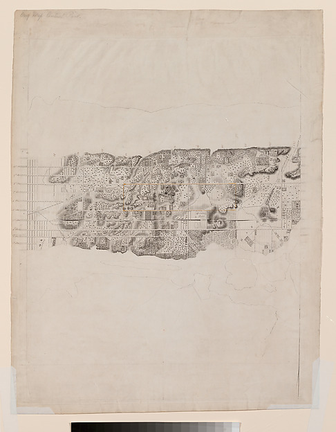
Topographical Map of the City and County of New-York and the Adjacent Country
David H. Burr (d. 1850)
1836–ca. 1858 · Engraving with additions in wash and black chalk
Cleared · Public Domain
liveThe MetSimilar
Rights clearance desk for images
Museums publish two different things about the same artwork: whether the work is in copyright, and whether their picture of it is. OpenPlate reads both, does the arithmetic on the published term, and shows you the sentence behind every point of the score.
Where this page got its records
259 ms. The Metropolitan Museum of Art, Collection API (Open Access)
48 ms. The Cleveland Museum of Art, Open Access API
2 of 2 providers answered live. 264 matching records exist across the two collections.
Institutions answered newest-first by record, interleaved
Topographical Map of the City and County of New-York and the Adjacent Country
David H. Burr (d. 1850)
1836–ca. 1858 · Engraving with additions in wash and black chalk
Cleared · Public Domain
liveNo open reproduction
The institution withholds the image for this record, which is itself the answer: the picture on their page is not theirs to give away.
Totius Neobelgii Nova et Accuratissima Tabula [A New and Very Accurate Map of the New Netherlands]
Hugo Allard (d. 1684)
1674 · Engraving and etching
In copyright
liveNo open reproduction
The institution withholds the image for this record, which is itself the answer: the picture on their page is not theirs to give away.
Totius Neobelgii Nova et Accuratissima Tabula [A New and Very Accurate Map of the New Netherlands]
Carel Allard (d. 1709)
ca. 1684 · Engraving and etching
In copyright
liveNo open reproduction
The institution withholds the image for this record, which is itself the answer: the picture on their page is not theirs to give away.
Totius Neobelgii Nova et Accuratissima Tabula [A New and Very Accurate Map of New Netherlands]
Reiner and Joshua Ottens (d. 1765)
ca. 1725 · Hand-colored etching and engraving
In copyright
liveNo open reproduction
The institution withholds the image for this record, which is itself the answer: the picture on their page is not theirs to give away.
A Map of Maryland and the Delaware Counties and the Southern Part of New Jersey &c., from the London Magazine
Thomas Kitchin (d. 1784)
August 1757 · Etching and engraving
In copyright
liveNo open reproduction
The institution withholds the image for this record, which is itself the answer: the picture on their page is not theirs to give away.
A New Map of Virginia, from the Best Authorities, from the London Magazine
Thomas Kitchin (d. 1784)
November 1761 · Etching and engraving
In copyright
liveNo open reproduction
The institution withholds the image for this record, which is itself the answer: the picture on their page is not theirs to give away.
A New and Correct Map of the Trading Part of the West Indies, including the Seat of War between Great Britain and France, Likewise the British Empire in America, with the French and Spanish Settlements...
Robert Sayer (d. 1794)
1756–63 · Etching and engraving, with hand-coloring
In copyright
liveNo open reproduction
The institution withholds the image for this record, which is itself the answer: the picture on their page is not theirs to give away.
A New and Correct Plan of the Town of Boston and Provincial Camp, from the Pennsylvania Magazine
Robert Aitken (d. 1802)
July 1775 · Etching and engraving
In copyright
liveNo open reproduction
The institution withholds the image for this record, which is itself the answer: the picture on their page is not theirs to give away.
A Correct Map of the Trading Part of the West Indies including the Seat of War between Great Britain and America
Robert Sayer (d. 1794)
18th century · Engraving
In copyright
liveNo open reproduction
The institution withholds the image for this record, which is itself the answer: the picture on their page is not theirs to give away.
Frontispiece: A New Map of India from the Latest Authority
Thomas Rowlandson (d. 1827)
October 1, 1815 · Hand-colored etching and aquatint
In copyright
liveNo open reproduction
The institution withholds the image for this record, which is itself the answer: the picture on their page is not theirs to give away.
A Correct View of the Old Methodist Church in John Street, New York
John Hill (d. 1850)
1823–24 · Hand-colored aquatint
In copyright
liveNo open reproduction
The institution withholds the image for this record, which is itself the answer: the picture on their page is not theirs to give away.
A Map Showing the Relative Situation of the Cities of New-York and Brooklyn
Alexander Martin (d. 1836)
1834–36 · Lithograph
In copyright
live1. Pin the work
Choose the record and say what you are actually going to do with it. The product re-reads the work live and stores a snapshot, so your docket records what the institution said today.
2. Read the arithmetic
Six weighted factors: the institution's own claim, the creator's term, the publication-age rule, the restrictions in their statement, your use, and whether a credit line is even possible.
3. Seal and export
Record the decision into a SHA-384 chain, then export a dated docket as JSON, CSV or Markdown with the credit line and the seal a colleague can re-verify.